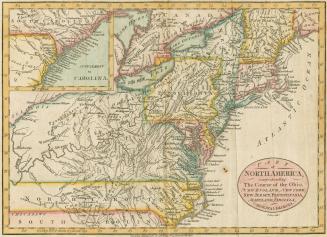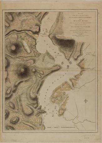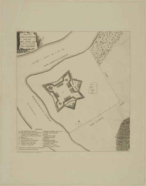
PLAN OF/ FORT LE QUESNE,/ Built by the/ French,/ At the Fork of the/ Ohio and Monongahela/ in 1754.
Date1755
Cartographer
Robert Stobo
(1727 - 1770)
Publisher
J. Payne
OriginEngland, London
MediumLine engraving on laid paper
DimensionsOverall: 13 1/2 × 12 1/4in. (34.3 × 31.1cm)
Framed: 22 1/4 × 20 7/8 × 3/4in.
Credit LineMuseum Purchase
Object number1985-74
DescriptionThe upper left cartouche reads: "PLAN OF/ FORT LE QUESNE,/ Built by the/ French,/ At the Fork of the/ Ohio and Monongahela/ in 1754."The lower left margin reads: "Publish'd according to the Act by J Payne in Pater noster row July 15.1755"
Label TextAlarmed by aggressive French encroachments that were becoming increasingly evident by 1753, Governor Robert Dinwiddie of Virginia dispatched a group of six men led by twenty-one-year-old George Washington to deliver to the French an ultimatum that they were to retreat from their newly constructed Fort le Boeuf. Their refusal to meet Dinwiddie's demands caused him to send a regiment of 150 men under Washington to arm an outpost at the forks of the Ohio. Unfortunately, support from other colonies whose interests were more directly threatened was not forthcoming.
On his way to the outpost, Washington received the news that the French had already captured the site and named it Fort Duquesne. The fort was mapped by Captain Robert Stobo while he was a prisoner there and smuggled out to the recently promoted Lieutenant Colonel Washington. The fort eventually became Fort Pitt in 1758 when the British, under the command of Brigadier Genereal John Forbes, Colonel George Washington, and Colonel Henry Bouquet, forced the French to retreat down the Ohio. Its site is presently the "Golden Triangle" in downtown Pittsburgh.