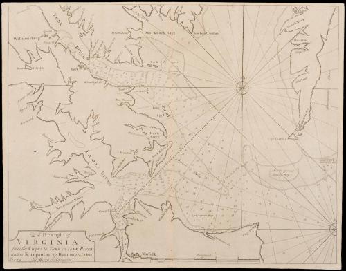
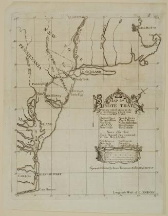
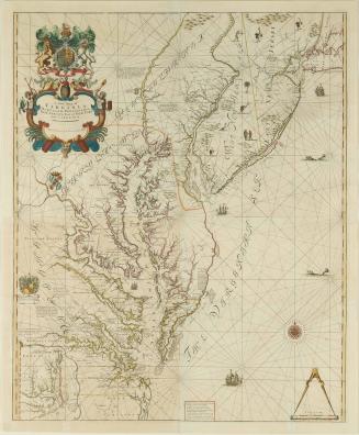
A Draught of Virginia from the Capes to York in York River and to Kuiquotan or Hamton in James River
Date1729
Cartographer
Mark Tiddeman (fl. ca. 1724-ca. 1760)
OriginEngland, London
MediumBlack and white line engraving
DimensionsOverall: 18 1/2 × 23 1/2in. (47 × 59.7cm)
Credit LineGift of William C. Wooldridge
Object number2017-282
DescriptionTitle in lower left corner: A Draught of/ VIRGINIA/ from the Capes to YORK in YORK RIVER/ and to Kuiquotan or Hamton in JAMES/ RIVER by Mark TiddemanBelow the neat line: Printed & Sold by Page & Mount on Tower Hill, London"
Label TextMark Tiddeman’s chart of the waters of Hampton Roads was published in The English Pilot, Fourth Book in 1729. Tiddeman, Master of a Royal naval ship sent to patrol the American coastline sailed from to Hampton Roads from New York from 1724-1728, collecting data as he went. This map was the first detailed map of any one region in Virginia and is the first published map to include Williamsburg and to show Norfolk as a town.
The Fourth Book of the English Pilot was one of the most important cartographic resources for those concerned with shipping and trade in eighteenth-century North American colonies.The book was originally published in 1671, and was published continuously until the nineteenth-century.
April 1, 1773
1723-1728, originally published ca. 1701

ca. 1875