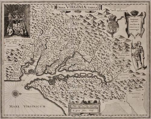
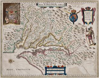
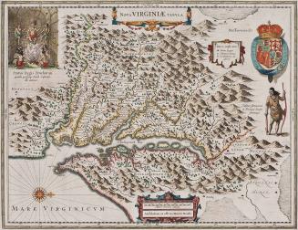
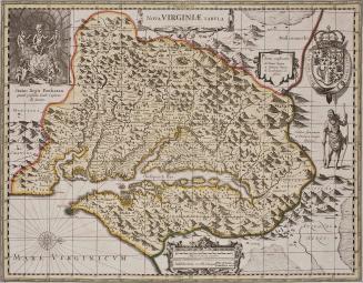
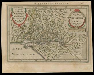
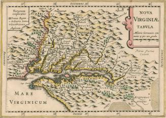
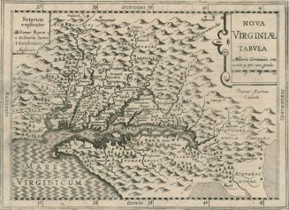
NOVA VIRGINIAE TABULA
Date1618
Maker
Jodocus Hondius II
(1594 - 1629)
After work by
Captain John Smith (1580-1631)
Engraver
Dirck Grijp
MediumBlack and white line engraving on laid paper with period color
DimensionsOH: 18 1/4" x OW: 23 1/2"
Credit LineMuseum Purchase
Object number2017-40
DescriptionThis is a derivative of the Captain John Smith's map of Virginia - Derivative 1, State 1.The text below Powhatan reads: "STATUS REGIS POWHATAN/ quando prefectus Smith Captivus/ illi daretur"
The key reads: "Notarum/ explicatio/ Domus Regum/ Ordinarie Domus/ Lucubrationes Anglo/ rum"
The text next to the Native American figure reads: "Habitus foeminarum/ in Provincia Sasque=/ sahanougs"
The scale cartouche reads: "Miliaria Germanica communia 15 pro Uno grado/ Ex officina Judoci Hondij/ D. Grijp./ Sculpt."
Label TextIn 1618, Jodocus Hondius Jr. copied the geographical information John Smith's important 1612 map of Virginia (State 1 - see acc. no. 2017-197). In addition to the map, Hondius copied a vignette depicting Powhatan in the upper left-hand corner and upper right corner, below the key is an image of a Susquehanna Indian from Virginia below it. The scale is at the bottom of the map.
This copy is published in William C. Wooldridge, "Mapping Virginia: From the Age of Exploration to the Civil War" (Charlottesville: University of Virginia Press, 2012), 37-39, #29.
1639-1642
c. 1700
1627
1624; originally published in 1616
Jan. 15, 1773