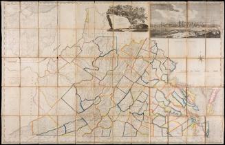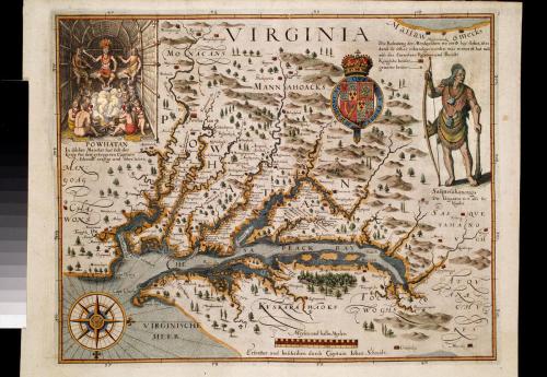
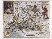
VIRGINIA
Date1627
Publisher
Matthaus Merian (1593-1650)
After work by
Captain John Smith (1580-1631)
MediumBlack and white line engraving with period hand color on laid paper
DimensionsOH: 13 7/8" x OW: 16"; Plate H: 11 3/8" x W: 14 3/8"
Credit LineMuseum Purchase
Object number1986-200
DescriptionThis is a derivative of Captain John Smith's map of Virginia - Derivative 3.The top center reads: "VIRGINIA"
The scale reads: "Meylen und halbe Meylen"
The bottom center reads: "Esforshet und beschriben durch Capitain Johan Schmidt."
In the upper left is an inset view of Powhatan and his warriers. The title, VIRGINIA, is in the upper center. The Susquehanna Indian is in the upper right. A compass rose is in the lower left. The scale of distances is in the lower center.
1624; originally published in 1616

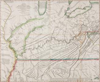
After 1735; originally published 1715