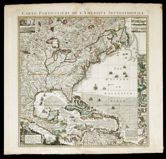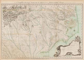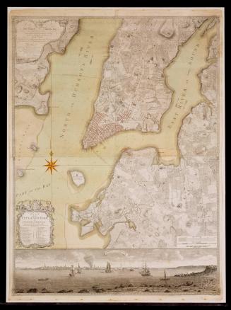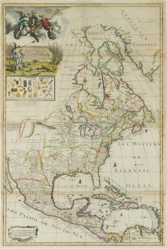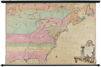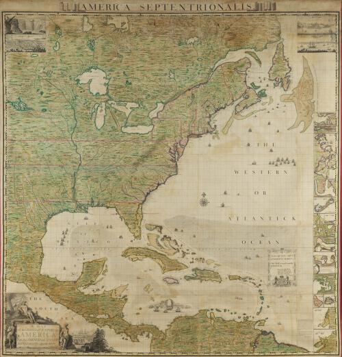
A MAP/ of the BRITISH EMPIRE in/ AMERICA/ with the FRENCH and SPANISH/ SETTLEMENTS adjacent thereto.
Date1733
Cartographer
Henry Popple (d. 1743)
Engraver
Bernard Baron
(ca. 1700 - 1766)
Engraver
William Henry Toms (fl. 1723-1758)
Engraver
Richard William Seale
(1732 - 1785)
After work by
Clement Lempriere
(b. 1716)
OriginEngland, London
MediumLine engraving on laid paper with hand color; mounted on linen
DimensionsOverall: 101 1/4 × 98 × 2 1/2in. (257.2 × 248.9 × 6.4cm)
In twenty sheets, attached and glued to linen
Credit LineMuseum Purchase
Object number1955-408
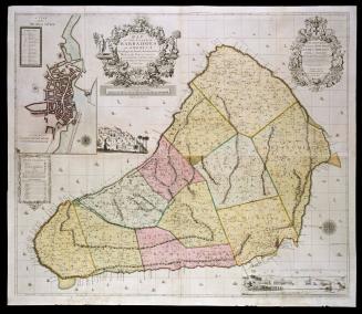
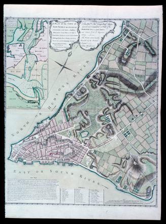
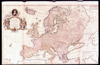
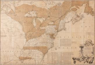
DescriptionThe cartouche in the lower left corner reads: "A MAP/ of the BRITISH EMPIRE in/ AMERICA/ with the FRENCH and SPANISH/ SETTLEMENTS adjacent thereto./ by Henry Popple./ C. Lempriere inv. & del./ B. Baron sculp."The lower right cartouche reads: "To the QUEEN's MOST/ EXCELLENT MAJESTY/ This MAP is most humbly/ Inscribed by/ Your MAJESTY's/ most Dutiful, most/ Obedient, and most/ Humble Servant/ Henry Popple."
Label TextThe most significant and interesting eighteenth century work in the field of cartography was the mapping of Colonial America. For the English, maps depicting holdings and boundaries were particularly important in light of previous conflicts with the French and Spanish. During the early years of the eighteenth century there was growing concern over French explorations in the Mississippi Valley, which stimulated map production for a variety of reasons. Colonial officials and colonists as well needed accuarate maps illustrating the land, waterways, forts, and settlements. Maps were also essential for domestic political reasons. They delineated and served to legitimize boundaries and helped define British economic interests in the New World. Henry Popple's map of the British Empire in America, his only major cartographic work, was the largest printed map of the continent made during the colonial period. Published in 1733, it was compiled from a variety of French and English sources available to him through family connections with the Lords Commissioners of Trade and Plantations. Although the map was criticized because Popple used numerous French sources that defined boundaries unfavorable to English claims, it was distributed by the Board of Trade to the government of every colony in America. During the eighteenth century this map could have been purchased mounted on rollers and colored, as this fine example is, bound in atlas form, or in twenty loose sheets.