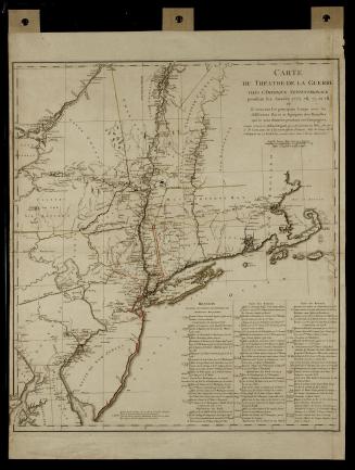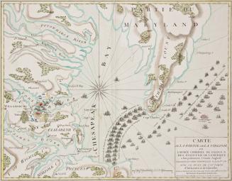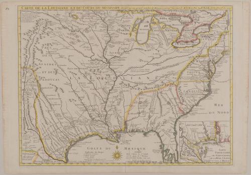
CARTE DE LA LOUISIANE ET DU COURS DU MISSISSIPI Dressée sur un grand nombre de Memoires entrau.tres sur ceux de M.r le Maire Par Guill.aume Delisle de
DateJune 1718
Cartographer
Guillaume de L'Isle (1675-1726)
OriginEurope, France, Paris
MediumBlack and white line engraving with period hand color on laid paper
DimensionsOH: 19 3/8" x OW: 25 3/4" (49.2 x 65.4cm)
Framed: 29 1/4" x 35" x 7/8"
Credit LineMuseum Purchase
Object number1953-202
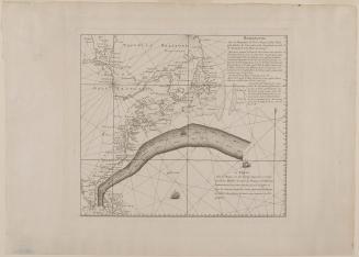
DescriptionThe upper margin reads: "CARTE DE LA LOUISIANE ET DU COURSE DU MISSISSIPI Dressee sur un grand nobmre de Memoires en trau.tres sur ceux de M.r le Maire Par Guill.aume Delisle des Academie R.le des Scien.ces"The bottom right inset map reads: "CARTE/ PARTICULIERE/ DES EMBOUCHRES/ DE LA RIVIE S LOUIS/ ET DE LA MOBILE"
The bottom center reads: "A PARIS/ Chez l'Auteur le S.r Delisle/ sur le Quay de l'Horloge/ avec Privilege du Roy Juin 1718."
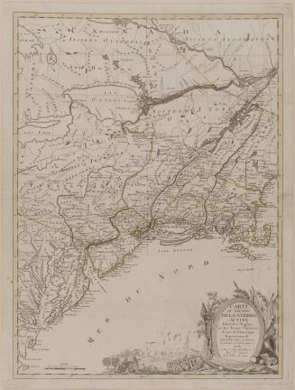
Label TextFrench expansionists at home and English colonists in America were actually aware of the advantages of gaining control of the American Southwest. The French realized that establishing footholds from the mouth of the Mississippi northward to New France would enable them to dominate the entire interior corridor of North America, thereby securing a monopoly of the fur trade and limiting English colonists to the Eastern Seaboard. The French would also be in a better position to threaten the gold and silver mines in the Southwest that had helped generate great wealth for the Spanish empire.
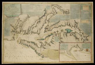
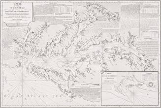
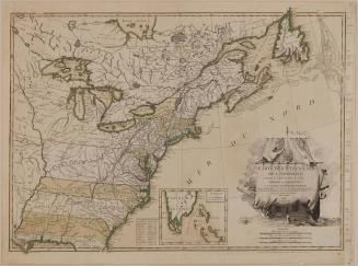
Covering the territory between the Hudson River in the east and the Rio Grande in the west, Guillaume Delisle's CARTE DE LA LOUISIANE ET DU COURS DU MISSISSIPI depicts the expansion of French territorial claims at the expense of the British and Spanish empires. Delisle mapped the routes taken by earlier French explorers as a means of documenting long-standing French presence in the area and establishing France's claim to the Ohio and Mississippi Valleys.
As mapmaker to the king, Delisle's maps were regarded as quasi-official documents that reflected the opinions and policies of the French government. Thus, this map caused great alarm in London and Madrid. Despite Delisle's controversial territorial claims on behalf of France, British cartographers recognized the importance of the geography he depicted and were quick to incorporate his work into their own. CARTE DE LA LOUISIANE ET DU COURS DU MISSISSIPI became a primary resource for the American Southwest for many years.
1780-1783