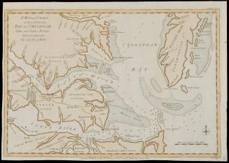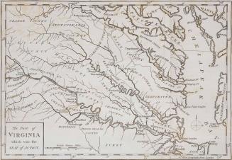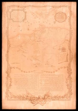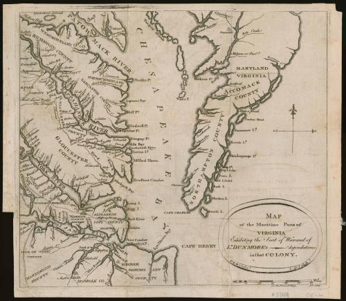
Map of the Maritime Parts of Virginia Exhibiting the Seat of War, and of Dunmore's depredations in that Colony
Date1776
Publisher
Robert Aitken
(1735 - 1802)
Maker
Pierre Eugène Du Simitière
(ca. 1736 - 1784)
MediumLine engraving on laid paper
DimensionsOH: 10 1/2" x OW: 12"
Credit LineMuseum Purchase
Object number2017-130
DescriptionCartouche (lower right) reads: "MAP/ of the Maritime Parts of/ VIRGINIA/ Exhibiting the Seat of War, and of/ L.d DUNMORE'S depredations/ in that COLONY./ P.E.D. Delin/t/ R.A Sculp."Lower margin reads: "for the Penn.a Mag. p. 184."
Label TextThis map is arguably the first to separately depict Virginia that was entirely drawn, engraved, and printed in what is now the United States. It was designed by Swiss émigré Pierre Eugene Du Simitiere and engraved by Robert Aitkin who published "The Pennsylvania Magazine" or "American Monthly Museum" in January 1775 through July 1776. It was only one of two American magazines that were published during the Revolution and Thomas Paine (author of "Common Sense") served as an editor in its early issues. The map appeared in the April 1776 issue of the "Pennsylvania Magazine" and was accompanied by a three-column article entitled "Some Account of the colony of Virginia." The mapmakers nod to current affairs in the cartouche which notes the "depredations" of Virginia's royal governor: John Murray, 4th Earl of Dunmore. In January 1776, Dunmore ordered the burning of the city of Norfolk and subsequently fled with the British fleet to New York, abandoning any hope of returning to Williamsburg as the royal governor. The map reflected an interest in current events, but offered little accurate or new cartographic information. Though it was designed and drawn by Pierre Eugene Du Simitiere, he faithfully copied the geography and orientation of Joshua Fry and Peter Jefferson's map of Virginia with minor differences and errors.
For more information see: Coolie Verner, "The AItkin Map of Virginia," 'Imago Mundi,' vol. 16 (1962), pp. 152-156.
This copy is published in William C. Wooldridge, "Mapping Virginia: From the Age of Exploration to the Civil War" (Charlottesville: University of Virginia Press, 2012), #145, pp. 154-155.