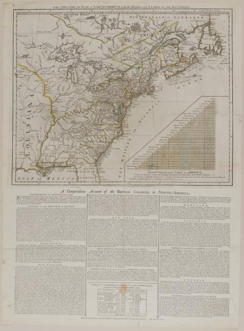
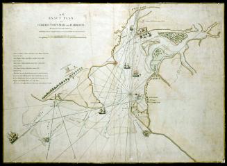
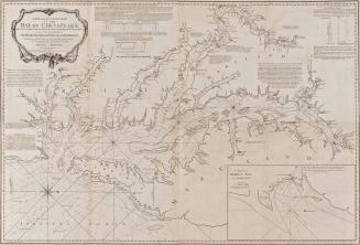
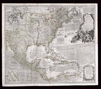
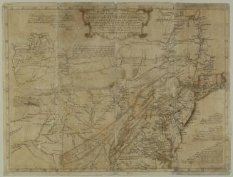
THE THEATRE OF WAR in NORTH AMERICA, with the ROADS and A TABLE OF THE DISTANCES.
DateMarch 20, 1776
Publisher
Robert Sayer (1725-1794) & John Bennett (fl. 1760-1787)
OriginEngland, London
MediumBlack and white line engraving with period hand color on laid paper
DimensionsOH: 16 1/2" x OW: 21"
Credit LineMuseum Purchase
Object number1955-126
DescriptionThe upper margin reads: "THE THEATRE OF WAR in NORTH AMERICA, with the ROADS and A TABLE OF THE DISTANCES."The title of the inset table reads: "EVAN'S POLYMETRIC TABLE OF AMERICA./ Shewing the Distances between the Principal Towns, Forts and Other Places in the British Colonies."
The lower margin reads: "London. Printed for R.t Sayer & Jn.o Bennett N.o 53 Fleet Street, as the Act directs 20.th March. 1776."
The title of the imprint below the map reads: "A Compendius Account of the BRITISH COLONIES in NORTH-AMERICA."
The lower margin of the imprint reads: "Printed for R. SAYER and J. BENNETT, Map and Print Sellers, No. 53, FLEET-STREET. Price ONE SHILLING."
Label TextAfter the skirmishes in the spring and summer of 1775, George III proclaimed that the colonies were in an open state of rebellion. For the English, another war across the Atlantic became inevitable. Map publishers were aware of the interest generated by the conflict and rushed to print works that would inform the public about the territory Britain was endeavoring to retain. One of the earliest maps produced to meet the demand was Robert Sayer and John Bennett's Theatre of War in North America.
The map illustrates Canada as far north as James Bay and New Britain, or Labrador, southward through about half of Florida and westward just beyond the Mississippi. Most of the geographical detail was borrowed from another map published by Sayer, Emanuel Bowen's An Accurate Map of North America. Bowen's map was an appropriate choice to copy since it delineated Britain's American holdings as defined by the Paris peace treaty at the end of the Seven Years' War.
No military details were provided: the map was made merely to document the extent and value of Britain's claims in America. In the lower right corner, the polymetric table showing distances between the principal towns, forts, and other places in America was borrowed from Lewis Evans's A general Map of the Middle British Colonies which, by this time, was being published by Sayer and Bennett as well.
The motive behind the production of this work-to document the importance of retaining the American colonies-was suggested in the text. Written accounts of Newfoundland, Canada, New England, New York, New Jersey, Pennsylvania, Delaware, Maryland, Virginia, the Carolinas, Georgia, and Florida described their advantageous features. Attention was given to the numbers and even to the types of homes occupied by the colonists and to the virtues of areas with pleasant streets or forests. At the lower center of the compendium is A Table of the Population of the British Colonies in North-America, published in New-Jersey, in November 1765.
One of the most curious features of this publication is that only eight months after it was produced, Sayer and Bennett reissued it again, but rather than just adding information to the existing copperplate, they had a new plate engraved. The map was pushed farther up on the plate so that James Bay and Labrador extended into and above the longitudinal marking line, thereby including all of Florida rather than the small portion found on the early issue. The only other change in the geography was that slight alterations were made in the rendering of the Mississippi River. Evan's Polymetric Table of America was illustrated as Corrected and Improved to include distances to more cities-Amboy, Burlington, Charlestown, New Bern, Pensacola, Saint Augustine, and Savannah. Another new feature, a Survey of the British Colonies, by Thomas Templeman, provided the square miles, length, breadth, and distance from London for twelve of the capital towns in North America. Sayer and Bennett included a title cartouche on the second map, noting that their new information was By An American.

June 10, 1775

July 17, 1776

August 11, 1755
February 16, 1775