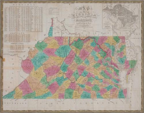
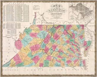
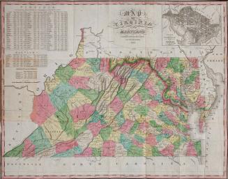
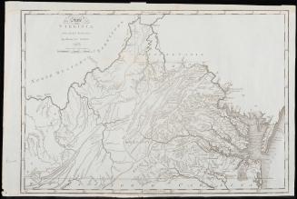
Map of Virginia and Maryland Constructed from the Latest Authorities[.] Published by S. Augustus Mitchell Philadelphia 1833
Date1833
Publisher
Samuel Augustus Mitchell
(1792 - 1868)
After work by
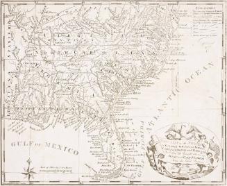
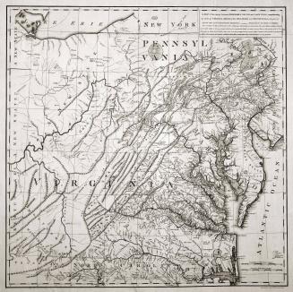
Anthony Finley
(1790-1840)
Engraver
James Hamilton Young
(fl. 1817 - 1866)
Compiler
David H. Vance
MediumCase: Red morocco leather stamped with gold gilt design and lettering, letterpress, paper, boards
Map: Black and white line engraving with period color.
DimensionsFolded (case): H: 5 1/4" x W: 3 3/16"; Unfolded (map): OH: 22 1/4" x OW: 17 3/4"
Credit LineMuseum Purchase
Object number2017-180
DescriptionCase: Title in stamped gold gilt letters reads: "VIRGINIA &/ MARYLAND"
Map unfolded:
Main title reads: "MAP/ OF/ VIRGINIA/ AND/ MARYLAND/ Constructed from the Latest/ AUTHORITIES/ Published by S. AUGUSTUS MITCHELL Philadelphia./ 1833"
Lower right corner: J. H. Young Sc."
Label TextThis map of Virginia and Maryland was published by Samuel Augustus Mitchell, who ran one of the most important map firms in the United States during the nineteenth century. When Anthony Finley retired, Mitchell bought the plates from Finley's 1826 atlas and republished them as in a new publication entitled "A New American Atlas" in 1831. This atlas was his first cartographic publication and it established his career as one of America's leading mapsellers.The maps were also published as pocket maps, like this one. Pocket maps gained popularity in the second decade of the nineteenth-century. Instead of being dissected, mounted on linen, folded and placed in separate map cases, these pocket maps were printed on thin paper and attached to boards into their own integral cardboard covers.
The data tables in the upper left inset are from the 1820 census. The inset in the upper right represents Washington, DC and Georgetown. The map was originally drawn by David H. Vance (D.H. Vance) and engraved by James Hamilton Young (J.H. Young).
This copy was published in William C. Wooldridge, "Mapping Virginia: From the Age of Exploration to the Civil War" (Charlottesville: University of Virginia Press, 2012), #198, pp. 212-216.

1826

1820/1823