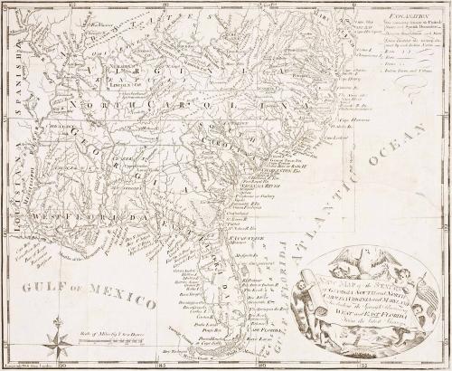
New Map of the States of Georgia, South and North Carolina Virginia and Maryland Including the Spanish Provinces ofWest and East Florida From the latest Surveys
Date1793
Maker
Cornelius Tiebout
MediumBlack and white line engraving
DimensionsOH: 12 3/4" x OW: 16 1/4"
Credit LineMuseum Purchase
Object number2017-118
DescriptionCartouche (lower right) reads: "NEW MAP of the STATES/ of GEORGIA SOUTH and NORTH/ CAROLINA VIRGINIA and MARYLAND/ Including the Spanish Province of/ WEST and EAST FLORIDA/ From the latest Survey."Label TextThis map depicting the Southeastern South Carolina was originally published in "Gordon's History and Rise of the United States." It features Indian settlements and boundaries, roads, and boundaries between the Spanish and American territories. The cartouche was derived from a frontispiece from Jedidiah Morse's "The American Geography" (1788).
This copy is published in William C. Wooldridge, “Mapping Virginia: From the Age of Exploration to the Civil War” (Charlottesville: University of Virginia Press, 2012), #135, p. 145.