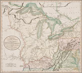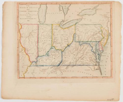
The Middle States and Western Territories of the United States including The Seat of the Western war 1812.
Date1812
Maker
Mathew Carey
(1760 - 1839)
MediumLine engraving on laid paper with period color
DimensionsOverall: 10 × 12in. (25.4 × 30.5cm)
Credit LineMuseum Purchase
Object number2017-121
DescriptionUpper left corner: "THE/ MIDDLE STATES/ and/ WESTERN TERRITORIES/ of the/ UNITED STATES/ including/ The seat of the Western War./ 1812."Label TextIn 1784, Virginia ceded all its land northwest of the Ohio River to the federal government. This land, commonly known as the "Northwest Territory," was organized under the 1787 Northwest Ordinance. This map shows several of the states formed from this land ceded from Virginia, including Illinois, Indiana, Ohio, and Kentucky.
This version appears in William C. Wooldridge, Mapping Virginia: From the Age of Exploration to the Civil War (Charlottesville: University of Virginia Press, 2012), pp. 145, 148