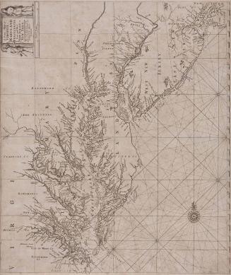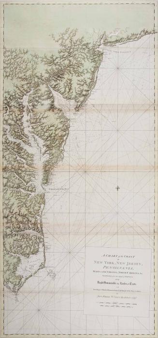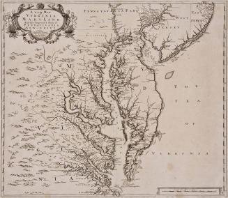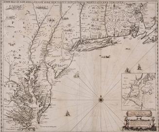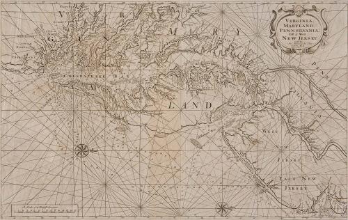
VIRGINIA, MARYLAND, PENNSILVANIA, East & West NEW JERSEY...
Date1743/1784
Publisher
John Thornton
Maker
John Mount
OriginEngland, London
MediumBlack and white line engraving
DimensionsOH: 23" x OW: 32 1/2"
Credit LineGift of Mr. and Mrs. Richard F. Barry, III, Mr. and Mrs. Macon F. Brock, Mr. and Mrs. David R. Goode, Mr. and Mrs. Conrad M. Hall, Mr. and Mrs. Thomas G. Johnson, Jr., Mr. and Mrs. Charles W. Moorman, IV, and Mr. and Mrs. Richard D. Roberts.
Object number2017-214
DescriptionTitle in cartouche: "VIRGINIA,/ MARYLAND,/ PENNSILVANIA,/ East & West/ NEW JERSEY./ Sold by Jn.o Mount & Tho.s Page/ Tower Hill."Label TextJohn Thornton and William Fisher first published a version of this chart of the Chesapeake and Delaware Bays, which is based on Augustine Herrman's earlier map of the area, in 1689 in "The English Pilot". In 1743, publishers Mount and Page (who published the book after Thornton's death in 1708) re-engraved the map on a new plate - the older one being perhaps worn out from use - and published it again until 1794. The chart's longevity is a testament to its usefulness to mariners in the area who turned to this chart for over one hundred years.
1723-1728, originally published ca. 1701