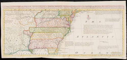
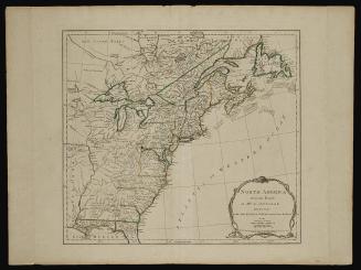
A Map of the British and French Settlements in North America
Date1755
Maker
Thomas Bowen
(1693/4 - 1767)
OriginEngland, London
MediumBlack and white line engraving with modern color.
DimensionsOH: 9 1/8" x OW: 19 5/8"
Credit LineMuseum Purchase
Object number2017-103
DescriptionTitle: A Map of the British and French Settlements in North America; [Part the Second] containing Part of New York, Pensilvania, New Jersey, Mary Land, Virginia, North & South Carolina/ Georgia, Louisiana, and all the Countries Westward in the same Parallels so far as Discovered, shewing the Course of the Rivers Ohio, Missisipi &c. exhibiting the just boundaries of the French Encroachments. Laid Down from Authentic Surveys.Label TextThis map was published in the General Magazine of Arts & Sciences in May 1755, several months after the publication of John Mitchell's influential map of the the British and French Dominions in North America, from which it draws some of its geography. See 1955-407.
This copy is published in William C. Wooldridge, "Mapping Virginia: From the Age of Exploration to the Civil War" (Charlottesville: University of Virginia Press, 2012), #121, p. 130.


June 10, 1775