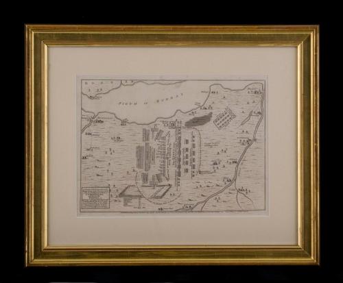
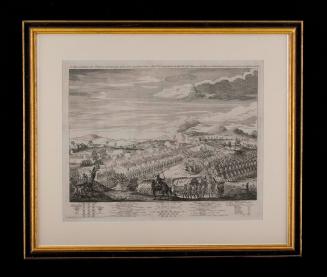
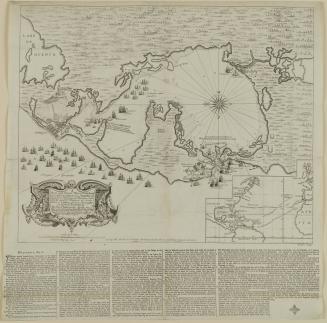
A PLAN of the Disposition of y.e/ Kings Army under the Command/ of His Royal Highness y.e Duke of/ CUMBERLAND,/ and that of the/ REBELS, at/ y.e Battle on Straghallen Moor near/ Culloden House April 16.th 1746.
DateMay 13, 1746
Publisher
Thomas Bowles II
(ca.1689 - 1767)
Publisher
John Bowles
(1701 - 1779)
OriginEngland, London
MediumBlack and white line engraving on laid paper
DimensionsOH: 17 1/4" x OW: 23" (framed); Plate H: 9 3/4" x W: 13 3/8"
Credit LineGift of Betty Leviner in memory of John Hyman
Object number2011-105
DescriptionThe lower left cartouche reads: "A PLAN of the Disposition of y.e/ Kings Army under the Command/ of His Royal Highness y.e Duke of/ CUMBERLAND,/ and that of the/ REBELS, at/ y.e Battle on Straghallen Moor near/ Culloden House April 16.th 1746./ Exhibiting a View of the Firth/ of Murray from Nairn to Inver-/ ness with the Adjacent Country."The lower margin reads: "Publish'd according to Act of Parliam.t May 13.th 1746. By Tho Bowles in S.t Pauls Church Yard & John Bowles at the Black Horse in Cornhill London/ Priced 6.d Plain & 1 shilling Colour'd"
Label TextThis plan depicts the position of the Duke of Cumberland's forces during the Battle of Culloden, the final confrontation of the 1745 Jacobite Rising. Taking place on 16 April 1746, the battle pitted the Jacobite forces of Charles Edward Stuart (House of Stuart) against an army commanded by William Augustus, Duke of Comberland, loyal to the British government and the reigning House of Hanover. Meeting on Culloden Moor, the battle was both quick and bloody, taking place within an hour. Following an unsuccessful Highland charge against the government lines, the Jacobites were routed and driven from the field.

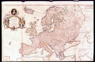
After 1735; originally published 1715

ca. 1755
ca. 1760